
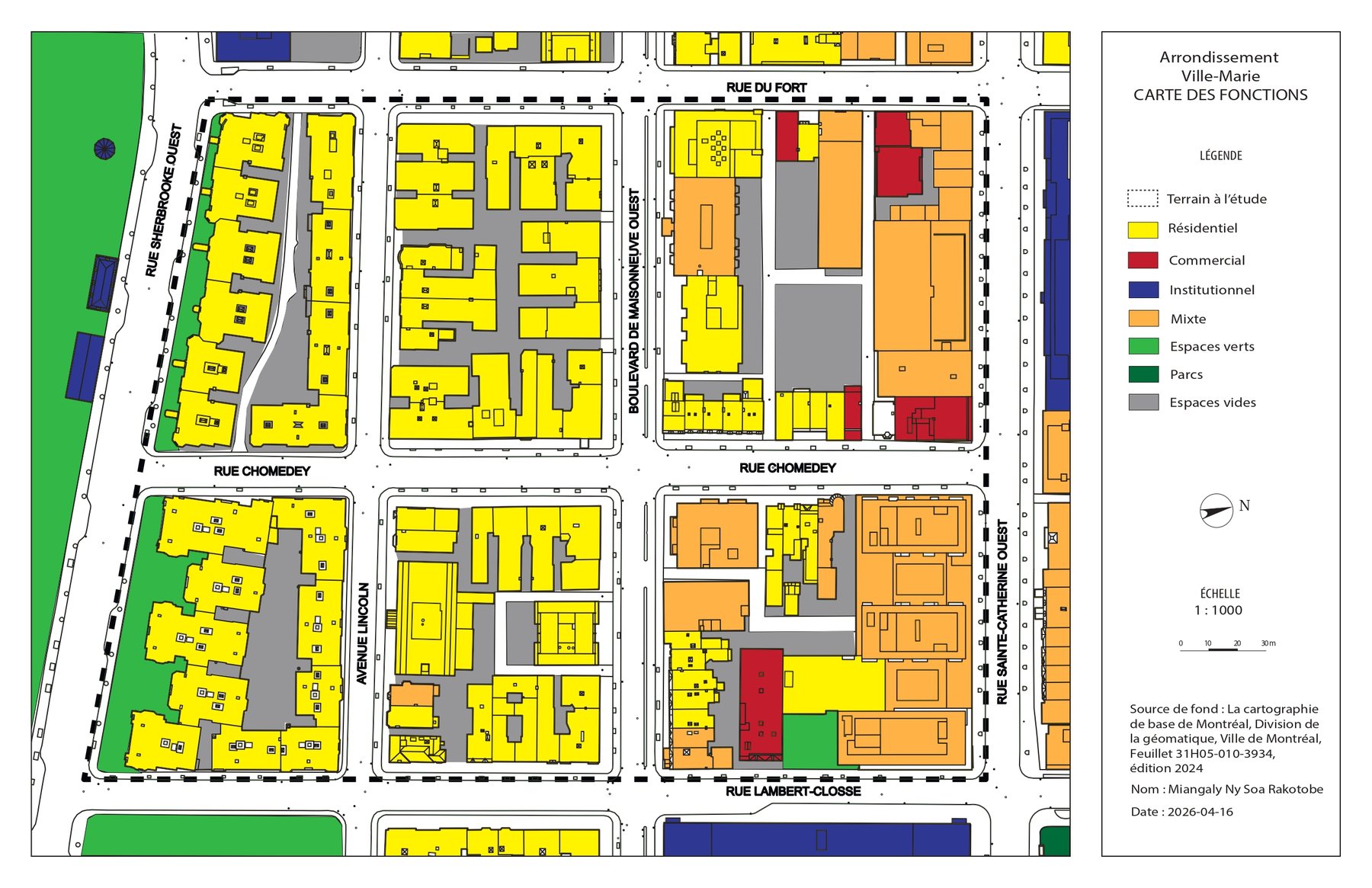
Land-use (functions) map of a Ville-Marie study sector
02, Project
Planning Studies & Technical Drawing
Ville-Marie, Longueuil & Toamasina
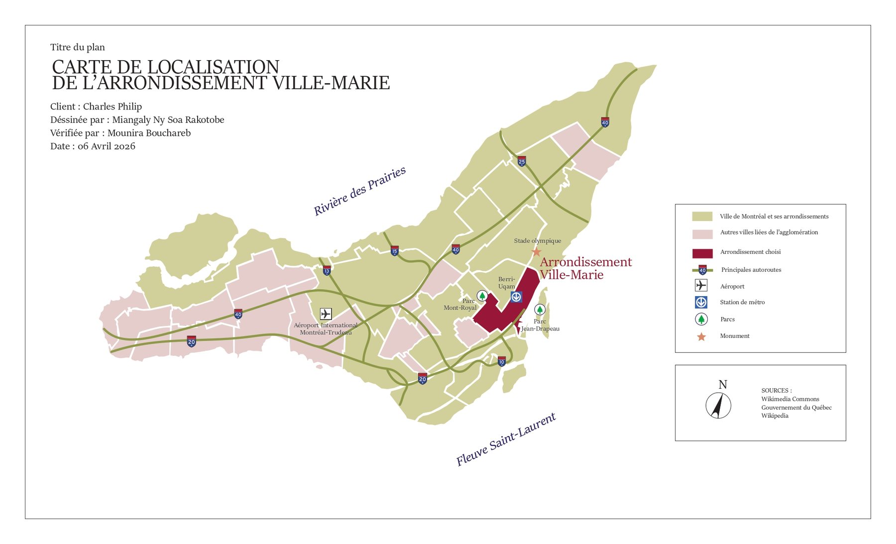
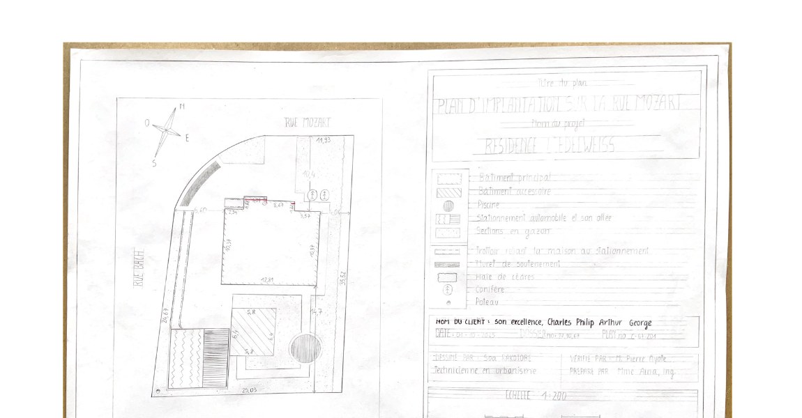
A set of academic planning work covering the full chain from reading a territory to drawing it. It includes a localisation map of the Ville-Marie borough in Montréal, a land-use (functions) map classifying residential, commercial, institutional, mixed, park, and vacant parcels across a study sector, and a residential site (implantation) plan drawn to scale at 1:200, locating a building on its lot and planning future site improvements while respecting scale and setbacks. Alongside the drawings, two written research reports analyse the development of a territory: one on Toamasina in Madagascar, and one rethinking urbanism along Boulevard Taschereau in Longueuil. Both reports are available to download below.